The old site is available at the link: https://old.spbgasu.ru/
Ру

enrolee-head.jpg

Department of Geodesy, Land Management and Cadastres

About the department

The department is graduating in the field of study "Land management and cadastres" under the bachelor's program "Urban Cadastre" and the master's program "Real Estate Cadastre of Urbanized Territories".

Bachelors of the "Urban Cadastre" program receive professional knowledge in the field of:
  • topographic and geodetic support of land management and cadastres;
  • land and property relations;
  • accounting, cadastral valuation and registration of real estate objects;
  • land surveying and formation of other real estate objects;
  • management systems for land resources and real estate;
  • inventory of real estate objects, monitoring of lands and other real estate.
The department conducts active research work. The main scientific directions are:
  • study of the geometric parameters of buildings and structures by geodetic methods;
  • development and application of laser equipment in mine surveying and geodesy;
  • reconstruction and assessment of the technical condition of buildings and structures, identification and prediction of deformations of buildings and their structural elements;
  • solution of transport problems of large and largest cities;
  • solution of issues of complex engineering improvement of urban areas;
  • resolving issues of cadastral registration of buildings, structures and land plots.
History Objectives

Contacts

Visiting address

Office 246, 4, 2nd Krasnoarmeiskaya Str., St Petersburg

Correspondence address

4, 2nd Krasnoarmeiskaya Str., St Petersburg, 190005

Е-mail
geo@spbgasu.ru
Map Scheme Faculty of Environmental Engineering and Municipal Services
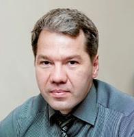
Aleksey V. Volkov

Welcome from the head of the department

Profile
Dear colleagues and friends!

Welcome to the webpage of the Department of Geodesy, Land Management and Cadastres.

Teachers of the department actively manage the research work of students. Every year, students conduct scientific research, which is drawn up within the framework of NIRS (Student Scientific Research Project) in the form of abstracts and articles.

The most significant results are published in the materials of the university and other publications. The department is equipped with the most modern geodetic instruments and equipment, which allows staff and students to perform a wide range of scientific and production tasks, the results of which are reflected in scientific articles, textbooks and teaching aids.

Fields of study

Bachelor’s degree

21.03.02 Land management and cadastres (Intramural studies)

More
Bachelor’s degree

21.03.02 Land management and cadastres (Extramural studies)

More
Master's degree

21.04.02 Land management and cadastres (Intramural studies)

More
#

Learn more about the department

Ошибка ввода
Ошибка ввода
Ошибка ввода
Ошибка ввода

By clicking «Send» you confirm that you agree to the processing of personal data and are familiar with the privacy policy